Urban Talks
  • Home
  • Maps
    • Vijayawada Land Prices Map
    • Amaravati Land Prices Map
  • Tutorials
    • GIS
  • Food
  • About Us

ARCGIS

GIS0014-2018.10.02-Orthorectification-of-UAV-generated-DTM-DSM-using-postprocessing-in-ArcGIS-feature
ARCGIS

GIS0014 2018.10.02 Orthorectification of UAV generated DTM DSM by postprocessing in ArcGIS

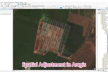
Summary – Orthorectification of UAV generated DTM DSM by postprocessing in ArcGIS. Orthorectification of UAV generated DTM DSM by postprocessing in ArcGIS, it requires DTM or DSM generated from PIX4d or Agisoft (any photogrammetry software) and GCPs to rectify data from. Two Steps: Finding error between GCP elevation and our Read more…

By Sandy, 7 yearsOctober 4, 2018 ago
GIS0012-2018.07.11-Adjusting-features-in-ArcGIS-using-Spatial-Adjustment-0.png
ARCGIS

GIS0013 2018.07.11 Adjusting features in ArcGIS using Spatial Adjustment

Summary – Adjusting features in ArcGIS using Spatial Adjustment. Adjust features in Arcgis using Spatial Adjustment tool. Two Steps: Configure Spatial Adjustment. Perform Adjustment. Procedure Configure Spatial Adjustment Start Editing from editor menu. Right click and enable Spatial Adjustment Tools. Click on Spatial Adjustment menu > Set adjust data. Choose Read more…

By Sandy, 7 yearsSeptember 7, 2018 ago
GIS0009-2018.02.17-GIS-Features-Updation-using-Autocad-featured-image
ARCGIS

Update GIS Features using AutocadMap

Summary – Update GIS Features using AutocadMap. Instructions provided describe how to update GIS features using AutocadMap , in the tutorial AutocadMap 3D has been used to update a Shapefile. We all miss the good  cad interface when dealing with GIS data whether it be tracing or other tasks, this Read more…

By Sandy, 7 yearsFebruary 17, 2018 ago
Start editing on new Shapefile
ARCGIS

Digitization of data from a WMS link make shapefiles and Geotiff

Summary – Create shapefiles or geotiff from a wms link using Arcgis or Qgis (digitization). Instructions provided describe how to Create shapefiles from a wms link using qgis or Arcgis, Data used for digitization is from Bhuvan Landuse WMS link at Bhuvan Store all credit goes to bhuvan and Other departments. Three Steps: Read more…

By Sandy, 8 yearsNovember 9, 2017 ago
My College submission sheet for Landuse Transition Matrix
GIS

Landuse Modeling for Change Detection (Transition Matrix) Using Qgis

Summary – Create a Transition Matrix for Landuse Change Detection in Qgis Instructions provided describe how to Create a Transition Matrix for Detecting changes in a Landuse of an area, Software used is Qgis and Plugin MOLUSCE, Data used is digitized from Bhuvan Landuse WMS link at Bhuvan Store all credit goes Read more…

By Sandy, 8 yearsNovember 9, 2017 ago
ARCGIS

How To: Create a Ground water level map for India in arcgis using data downloaded from CGWD

Summary – Create a Ground water level map for India in arcgis Instructions provided describe how to Create a Ground water level map for India in arcgis using CGWD data downloaded from this page for full india http://www.india-wris.nrsc.gov.in/GWL/GWL.html Three Steps: Download data from CWD data portal Prepare data for making map Read more…

By Sandy, 8 yearsOctober 15, 2017 ago
ARCGIS

How To: Create a Geodatabase in ArcGis and import files in it

Summary – Create a Geodatabase in ArcGis and import files in it Instructions provided describe how to Create a Geodatabase in ArcGis and import files in it Procedure Create a new geo-database Click on Catalog from sidebar or windows menu. Right click on the folder from catalog where you want Read more…

By Sandy, 8 years ago
ARCGIS

How To: Repair data source Fix data error in Arcgis file

Summary – Repair data source Fix data error in Arcgis file Instructions provided describe how to Repair data source Fix data error in Arcgis file Procedure Open the Repair Data Source Dialog Box Open Table of Contents pane from side menu or Windows menu. Right click on the layer of Read more…

By Sandy, 8 years ago
ARCGIS

How To: Select features in a shapefile by using select by Location tool with Interested Area in Arcgis

Summary – Select features in a shapefile using select by Location tool with Interested Area in Arcgis Instructions provided describe how to Select features in a shapefile by using select by Location tool with Interested Area in Arcgis Procedure Select features by using select by Location tool From Selection menu Read more…

By Sandy, 8 yearsOctober 15, 2017 ago
ARCGIS

How To: Select features using Select by Attribute (data column) in a shapefile in Arcgis

Summary – Select features using Select by Attribute Instructions provided describe how to Select features using Select by Attribute (data column) in a shapefile in Arcgis. Procedure Select features by Select by Attribute tool From Selection menu click on From Selection menu click on  select by Attribute option. Select the Layer which Read more…

By Sandy, 8 yearsOctober 15, 2017 ago

Posts pagination

1 2 Next
ads by google
Recent Posts
  • Parking Development Cost Calculator by Krishna Kumar Srivastava
  • GIS0016 2019.09.04 Landuse Pixelation to Identify Major Landuse by Area in each Grid
  • MAP-5 Jaipur City Map 06-05-2019
Recent Comments
  • [ QGIS ] – Origin Destination Matrix – The Easy Way (QGIS 2.x and QGIS 3.x) | All Around GIS on Origin Destination Matrix In Gis The Easy Way
  • Sandeep Kumar on Mapping Damage to Structures From Hurricane Harvey in Harris County (Houston)
  • Sandeep Kumar on How To: Create a Ground water level map for India in arcgis using data downloaded from CGWD
Archives
  • June 2021
  • September 2019
  • May 2019
  • April 2019
  • November 2018
  • October 2018
  • September 2018
  • July 2018
  • March 2018
  • February 2018
  • January 2018
  • December 2017
  • November 2017
  • October 2017
Categories
  • ARCGIS
  • Autocad
  • City Maps
  • DATA SCIENCE
  • Drones/UAV
  • Environment
  • Food
  • GIS
  • Landuse
  • Maps
  • Project Management
  • python
  • QGIS
  • Software
  • Transport
  • TUTORIALS
  • Uncategorized
  • Urban Planning
  • Water
Calender for posts
June 2025
S M T W T F S
1234567
891011121314
15161718192021
22232425262728
2930  
« Jun    

  • Home
  • Maps
  • Tutorials
  • Food
  • About Us
Hestia | Developed by ThemeIsle