Summary – GIS0016 2019.09.04 Landuse Pixelation to Identify Major Landuse by Area in each Grid.
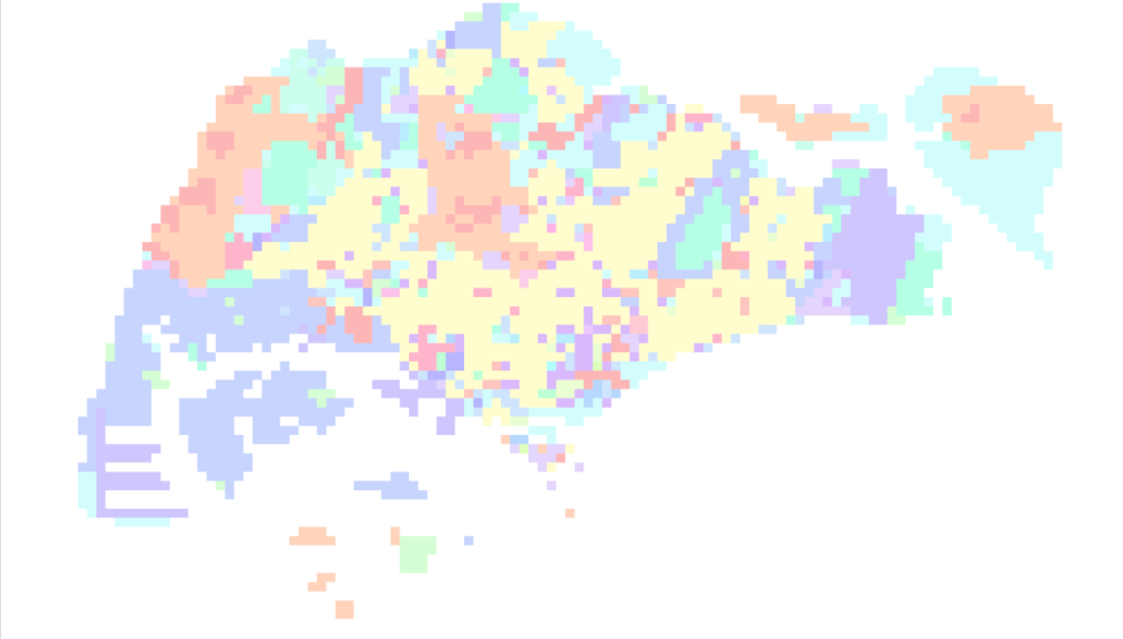
Landuse Pixelation to Identify Major Landuse by Area in each Grid using ArcGIS Pro, ArcMap, Qgis. For this tutorial, we have used the Singapore landuse layer (2014) link here.
Procedure
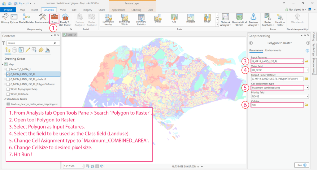
ArcGIS Pro
- From Analysis tab Open Tools Pane > Search
Polygon to Raster. - Open tool Polygon to Raster.
- Select Polygon as Input Features.
- Select the field to be used as the Class field (Landuse).
- Change Cell Assignment type to
Maximum_COMBINED_AREA. - Change Cell size to the desired pixel size.
- Hit Run!
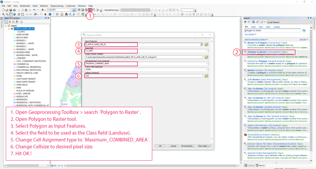
ArcMap
- Open Geoprocessing Toolbox > search
Polygon to Raster. - Open Polygon to Raster tool.
- Select Polygon as Input Features.
- Select the field to be used as the Class field (Landuse).
- Change Cell Assignment type to
Maximum_COMBINED_AREA. - Change Cell size to the desired pixel size.
- Hit OK!
Qgis
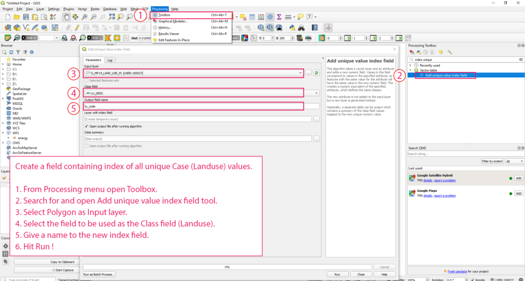
Create a field containing an index of all unique Case (Landuse) values
- .From Processing menu open Toolbox.
- Search for and open Add unique value index field tool.
- Select Polygon as the Input layer.
- Select the field to be used as the Class field (Landuse).
- Give a name to the new index field.
- Hit Run ! Open Geoprocessing Toolbox > search
Polygon to Raster.
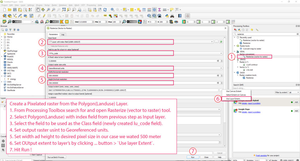
Create a Pixelated raster from the Polygon(Landuse) Layer.
- From Processing Toolbox search for and open Rasterize (vector to raster) tool.
- Select Polygon(Landuse) with the index field from the previous step as the input layer.
- Select the field to be used as the Class field (newly created lu_code field).
- Set output raster units to Georeferenced units.
- Set width ad height to desired pixel size in our case we used 500 meter
- Set OUtput extent to the layer’s by clicking … button >
Use layer Extent. - Hit Run !
Tadda done!!
if you like the tutorial please spread the word and comment below if you have any questions.
