Summary – Create a Ground water level map for India in arcgis
Instructions provided describe how to Create a Ground water level map for India in arcgis using CGWD data downloaded from this page for full india http://www.india-wris.nrsc.gov.in/GWL/GWL.html
Three Steps:
- Download data from CWD data portal
- Prepare data for making map
- Plot points for well from the data
- interpolate ground water level map from points
Procedure
Download data from CGWD Portal
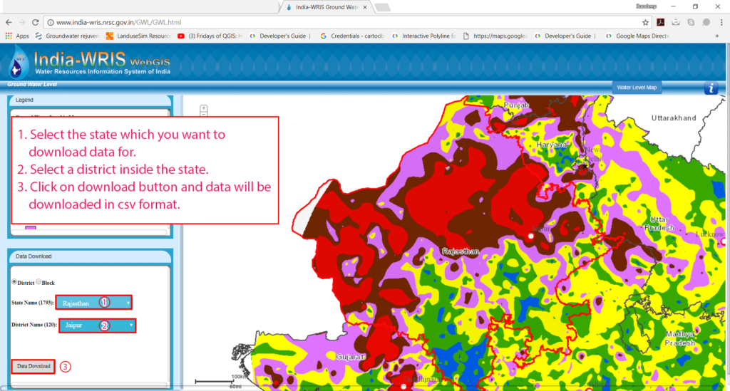
Source : CGWD PORTAL – http://www.india-wris.nrsc.gov.in/GWL/GWL.html
- Select the state which you want to download data for.
- Select a district inside the state.
- Click on download button and data will be downloaded in csv format.
- If you want to make map for a whole state or multiple districts, download data for all the disctricts you want to make map.
Prepare data for Making Map
Source : CGWD PORTAL – http://www.india-wris.nrsc.gov.in/GWL/GWL.html
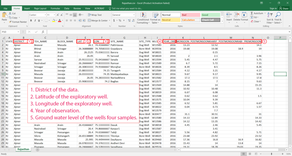
- Copy paste data for multiple districts files (if any) to one file as columns are for every file.
- Make separate csv file for each year you want to make map.
- like 2000.csv, 2005.csv, 2010.csv, 2015.csv
Plot Points from the data
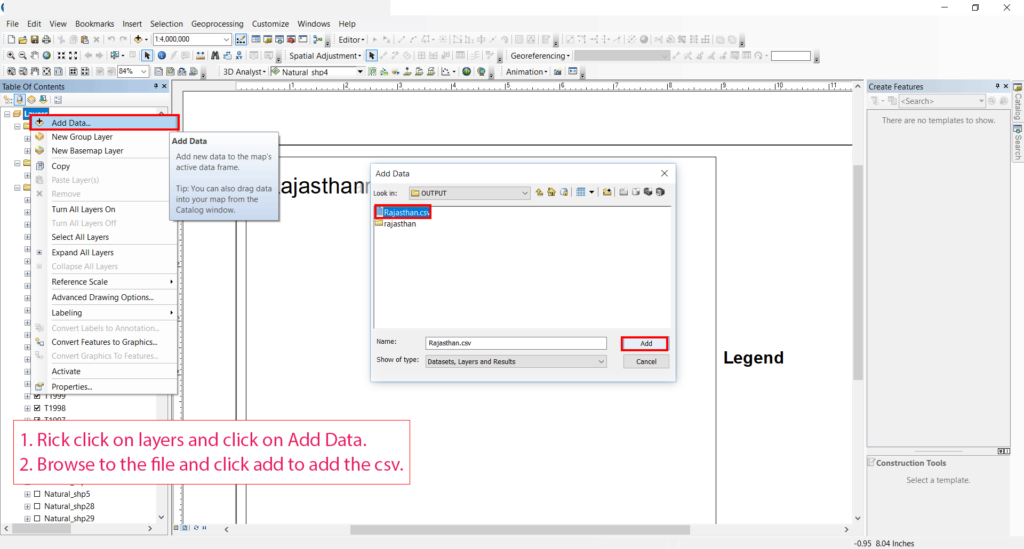
- Rick click on layers and click on Add Data.
- Browse to the file and click add to add the csv.

- Right Click on the Csv Layer and click on Display XY Data.
- Select X field as LON (Longitude).
- Select Y field as LAT (Latitude).
- Set Geographic Coordinate System to GCS_WGS_1984
- Click OK to plot Points.
interpolate ground water level map from points
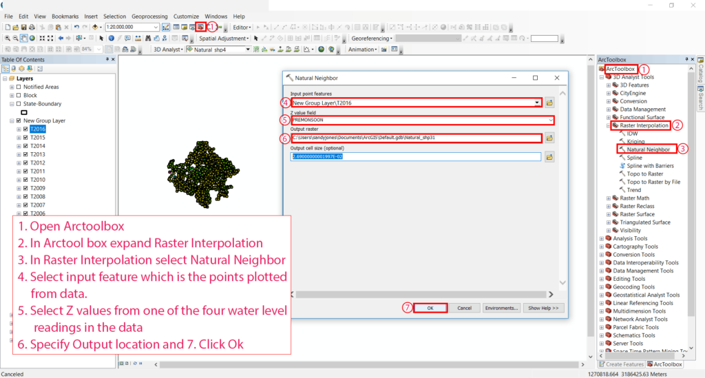
- Open ArctoolboxOpen Arctoolbox.
- In Arctool box expand Raster Interpolation.
- In Raster Interpolation select Natural Neighbor.
- Select input feature which is the points plotted from data.
- Select Z values from one of the four water level readings in the data.
- Specify Output location.
- Click Ok
Source : CGWD PORTAL – http://www.india-wris.nrsc.gov.in/GWL/GWL.html
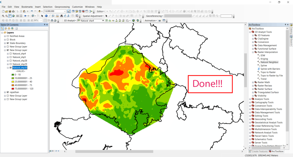
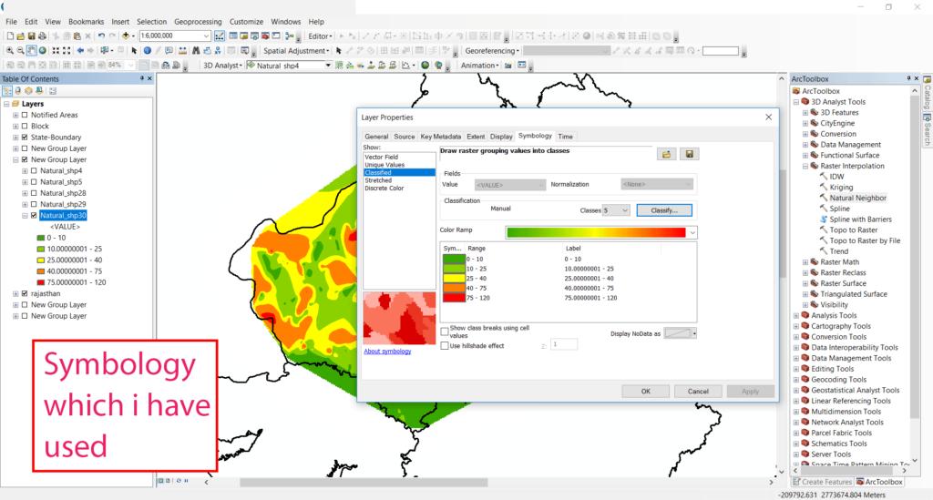
Tadda done!! I have styled this map according to the values of the field
Source : CGWD PORTAL – http://www.india-wris.nrsc.gov.in/GWL/GWL.html
Want to Know How to Style maps See tutorial on styling maps.