Summary – Get Elevation of Points using Dem file.
Instructions provided describe how to Get Elevation of Points using Dem files.
Two Steps:
- Interpolate 3d for the layer Using a dem file.
- Get Elevations to attribute table using Calculate Geometry tool.
Note : If you are facing any difficulty following this tutorial please download the sample files from the link below
Procedure
Interpolate 3d for the layer Using a dem file
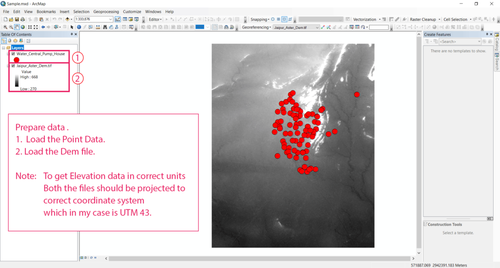
Prepare Data
Prepare Data:
- Load the Point Data.
- Load the Dem file.
Note : To get Elevation data in correct units Both the files should be projected to correct coordinate system which in my case is UTM 43.
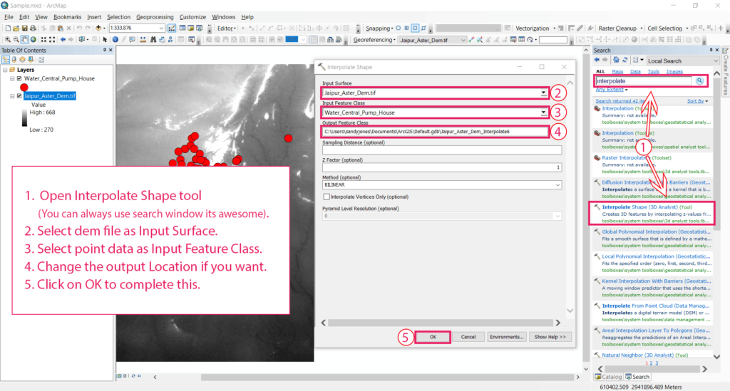
Interpolate 3d data for the point file
Interpolate 3d data for the point file :
- Open Interpolate Shape tool (You can always use search window it’s awesome).
- Select dem file as Input Surface.
- Select point data as Input Feature Class.
- Change the output Location if you want.
- Click on OK to complete this.
Note : If you are facing any difficulty following this tutorial please download the sample files from the link below
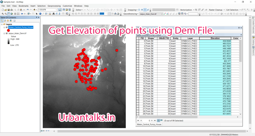
Get Elevations to attribute table using Calculate Geometry tool
GIS0011-2018.03.10-Get-Elevation-of-Points-using-Dem-files-3
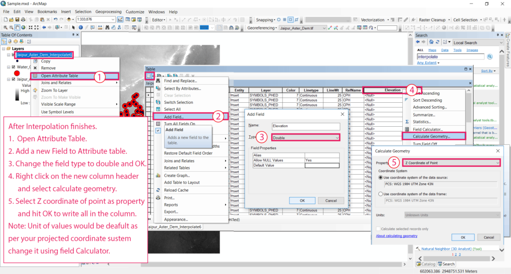
Interpolate 3d data for the point file copy, After Interpolation finishes:
- Open Attribute Table.
- Add a new Field to the Attribute table.
- Change the field type to double and OK.
- Right-click on the new column header and select calculate geometry.
- Select Z coordinate of point as property and hit OK to write all in the column.
Note: Unit of values would be default as per your projected coordinate system change it using Field Calculator.
Tadda done!!
Tadda Done.
Note : If you are facing any difficulty following this tutorial please download the sample files from the link below