City Maps
MAP-4 Kanpur City Map 28-04-2019
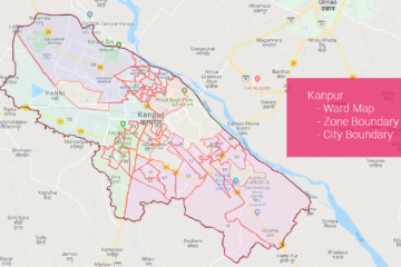
Kanpur City Map Download Data Used in this Map in Geojson or Shapefile format from here Source of Data: Datameet Municipal Spatial Data.
Map is the most convinent form to depict information having a spatial dimension.
Kanpur City Map Download Data Used in this Map in Geojson or Shapefile format from here Source of Data: Datameet Municipal Spatial Data.
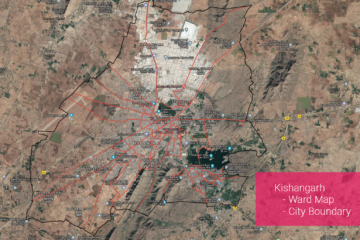
Kishangarh City Map Download Data Used in this Map in Geojson or Shapefile format from here Source of Data: Datameet Municipal Spatial Data.
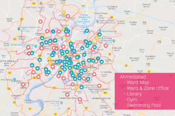
Ahmedabad City Map Download Data Used in this Map in Geojson or Shapefile format from here Source of Data: Datameet Municipal Spatial Data.
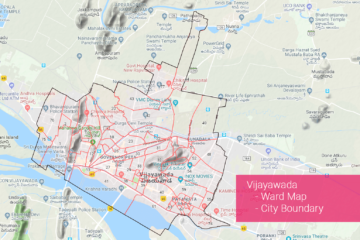
Vijayawada City Map Download Data Used in this Map in Geojson or Shapefile format from here Source of Data: Datameet Municipal Spatial Data.
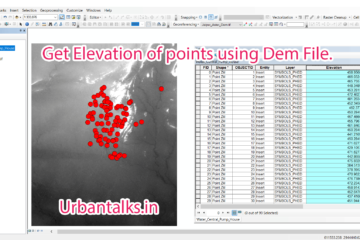
Summary – Get Elevation of Points using Dem file. Instructions provided describe how to Get Elevation of Points using Dem files. Two Steps: Interpolate 3d for the layer Using a dem file. Get Elevations to attribute table using Calculate Geometry tool. Note : If you are facing any difficulty following this Read more…
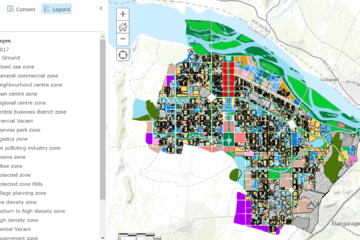
Want to explore the Future Landuse of Amaravati, click on this URL. Original Website : GIS.APCRDA.ORG Amaravati LPS Map Published by GIS Department of APCRDA : https://gis.apcrda.org/lps/index.html Amaravati LPS Map Published by GIS Department of APCRDA : https://gis.apcrda.org/lps/index.html
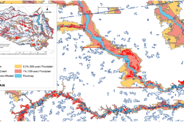
Mapping damage from Hurricane Harvey in Harris County General Details Metadata of layers in MAP Source : Hcad Parcel and line Datasets, Fema National Flood Hazard Layer, U.S. Department of Housing and Urban Development Flood Extent Layer.