Want to explore the Future Landuse of Amaravati, click on this URL.
Original Website : GIS.APCRDA.ORG
Amaravati LPS Map Published by GIS Department of APCRDA : https://gis.apcrda.org/lps/index.html
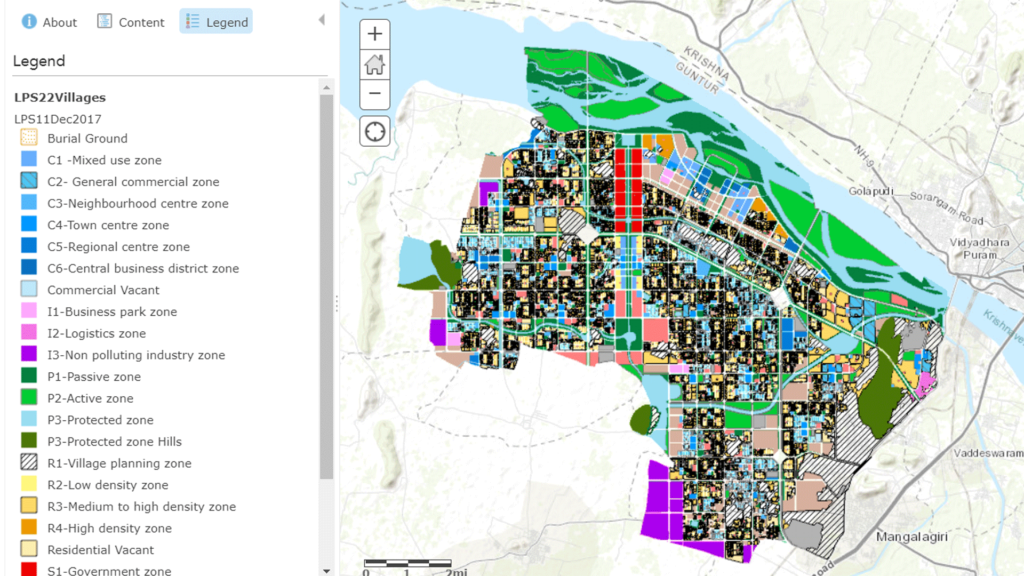
Amaravati Map
Amaravati LPS Map Published by GIS Department of APCRDA : https://gis.apcrda.org/lps/index.html