Urban Talks
  • Home
  • Maps
    • Vijayawada Land Prices Map
    • Amaravati Land Prices Map
  • Tutorials
    • GIS
  • Food
  • About Us

April 2019

City Maps

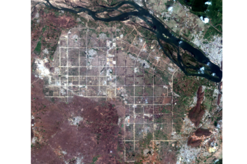
MAP-4 Kanpur City Map 28-04-2019

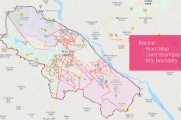
Kanpur City Map Download Data Used in this Map in Geojson or Shapefile format from here Source of Data: Datameet Municipal Spatial Data.

By Sandy, 6 yearsApril 28, 2019 ago
City Maps

MAP-3 Kishangarh City Map 28-04-2019

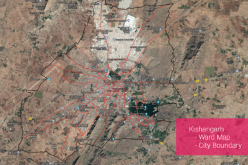
Kishangarh City Map Download Data Used in this Map in Geojson or Shapefile format from here Source of Data: Datameet Municipal Spatial Data.

By Sandy, 6 yearsApril 28, 2019 ago
City Maps

MAP-2 Ahmedabad City Map 28-04-2019

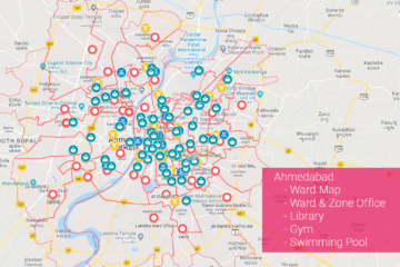
Ahmedabad City Map Download Data Used in this Map in Geojson or Shapefile format from here Source of Data: Datameet Municipal Spatial Data.

By Sandy, 6 yearsApril 28, 2019 ago
City Maps

MAP-1 Vijayawada City Map 28-04-2019

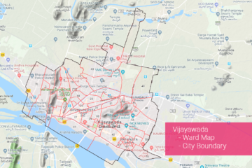
Vijayawada City Map Download Data Used in this Map in Geojson or Shapefile format from here Source of Data: Datameet Municipal Spatial Data.

By Sandy, 6 yearsApril 28, 2019 ago
Uncategorized

GIS0015 2019.04.05 Tracking Amaravati from Space using Sentinal Imagery and Python – A Time Series

Summary – We Tracked Amaravati from the time its foundation stone was laid down in back in 2015 till Now, The results will surprise you. Amaravati is the capital of separated state of Andhra Pradesh and due to the continuous effort from all the entities involved in it ranging from Read more…

By Sandy, 7 yearsApril 5, 2019 ago
ads by google
Recent Posts
  • Parking Development Cost Calculator by Krishna Kumar Srivastava
  • GIS0016 2019.09.04 Landuse Pixelation to Identify Major Landuse by Area in each Grid
  • MAP-5 Jaipur City Map 06-05-2019
Recent Comments
  • [ QGIS ] – Origin Destination Matrix – The Easy Way (QGIS 2.x and QGIS 3.x) | All Around GIS on Origin Destination Matrix In Gis The Easy Way
  • Sandeep Kumar on Mapping Damage to Structures From Hurricane Harvey in Harris County (Houston)
  • Sandeep Kumar on How To: Create a Ground water level map for India in arcgis using data downloaded from CGWD
Archives
  • June 2021
  • September 2019
  • May 2019
  • April 2019
  • November 2018
  • October 2018
  • September 2018
  • July 2018
  • March 2018
  • February 2018
  • January 2018
  • December 2017
  • November 2017
  • October 2017
Categories
  • ARCGIS
  • Autocad
  • City Maps
  • DATA SCIENCE
  • Drones/UAV
  • Environment
  • Food
  • GIS
  • Landuse
  • Maps
  • Project Management
  • python
  • QGIS
  • Software
  • Transport
  • TUTORIALS
  • Uncategorized
  • Urban Planning
  • Water
Calender for posts
April 2019
S M T W T F S
 123456
78910111213
14151617181920
21222324252627
282930  
« Nov   May »

  • Home
  • Maps
  • Tutorials
  • Food
  • About Us
Hestia | Developed by ThemeIsle