Summary – Adjusting features in ArcGIS using Spatial Adjustment.
Adjust features in Arcgis using Spatial Adjustment tool.
Two Steps:
Procedure
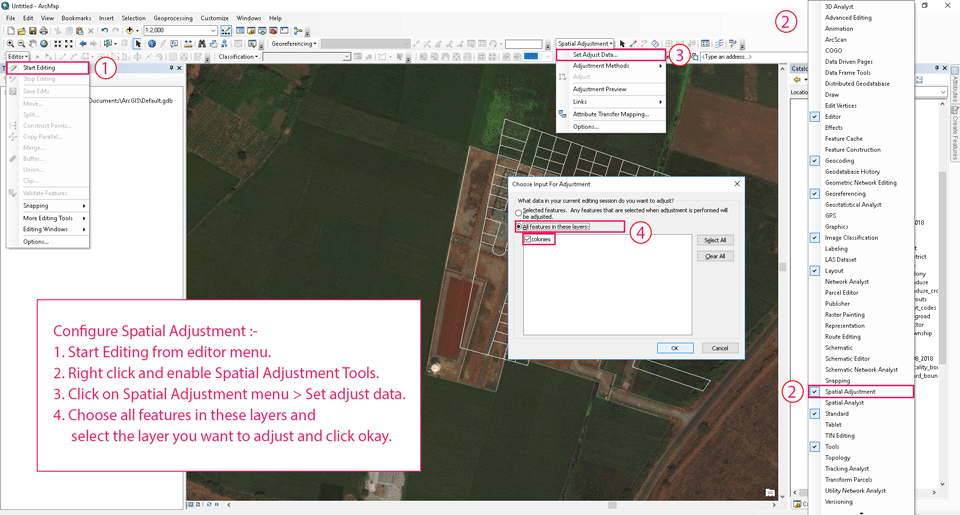
Configure Spatial Adjustment
Configure Spatial Adjustment
- Start Editing from editor menu.
- Right click and enable Spatial Adjustment Tools.
- Click on Spatial Adjustment menu > Set adjust data.
- Choose all features in these layers and select the layer you want to adjust and click okay.
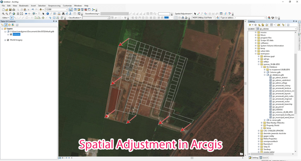
Make Displacement Links to adjust data

Make Displacement Links to adjust data
- Turn on Displacement Link Tool.
- Add displacement links how you want to adjust the geometry of the features in the layer.
Perform Adjustment
GIS0012-2018.07.11-Adjusting-features-in-ArcGIS-using-Spatial-Adjustment-2
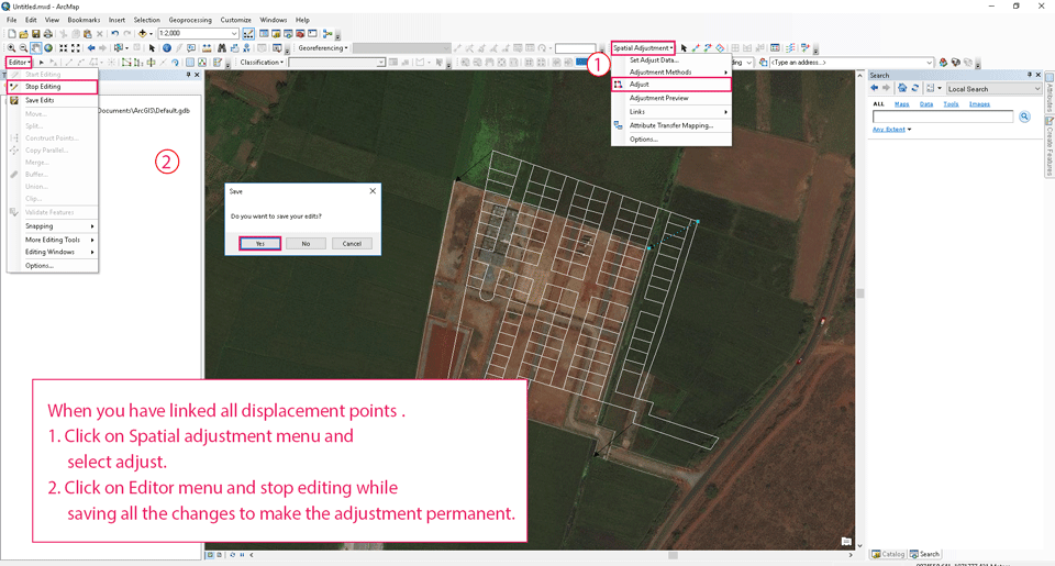
- Click on Spatial adjustment menu and select adjust.
- Click on Editor menu and stop editing while saving all the changes to make the adjustment permanent.
Tadda done!!
Result
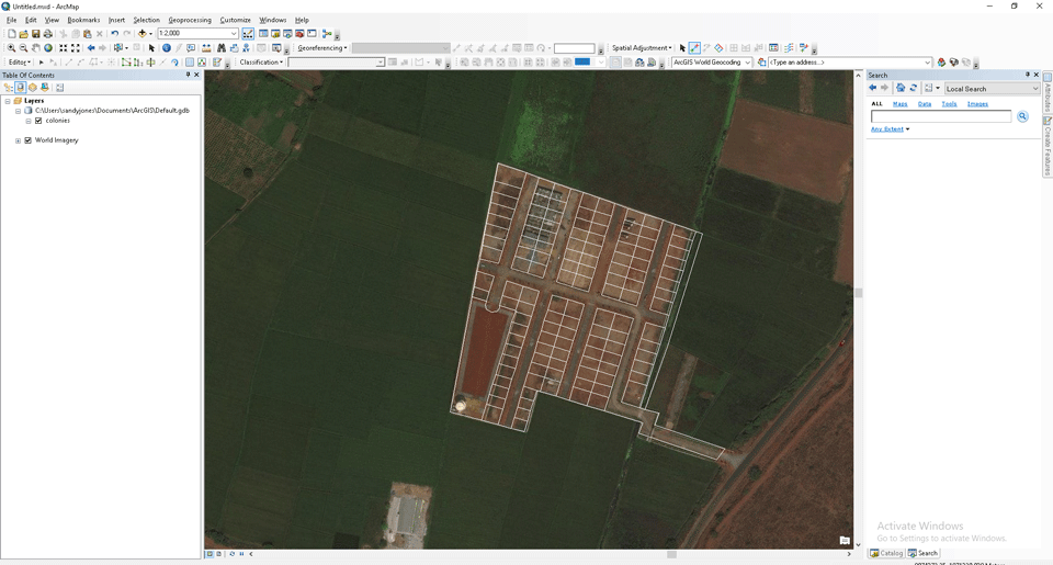
Feature Image
if you like the tutorial please spread the word aand comment below if you have any questions.